
GIS and Database Set-Up and Management at Watershed Greece

Creating and Managing a Spatial Database for NGOs and Gov. Bodies to access a Synchronised Camp Map
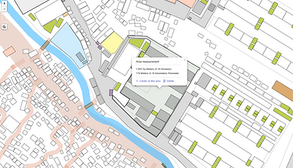
After more than a year of routinised mapping activities among NGOs in the Greek Mavrovouni Camp, a synchronised and protected option for mapping became necessary to reduce the high maintenance efforts that were building up. As of 2021 various NGOs and government bodies access a QGIS map set up with layers on a database to view or edit certain camp layers.


Putting Moria RIC on a Map
Moria Refugee camp lacked up-to-date geospatial data*. With QGIS and UAV imagery I created a highly detailed GIS map of Moria, containing a variety of information based on the local knowledge of Watershed and other NGOs operating inside the camp. These maps was shared with all partner organisations within the camp.
Some of the thematic maps included:
Fire safety, evacuation, WASH network (underground and above ground water supply and drainage), WASH condition assessments, shelter assessment, population density, etc.
*In later years, I discovered that a variety of Earth Observation projects had been performed by external organisations to map the camp, but these never reached any local NGOs operating on the ground.


A Shelter Working Tool
I teamed up with the main shelter organisation in the new Mavrovouni RIC on Lesbos to create, set up, and maintain a detailed camp map (QGIS) for them and help with any training of their own members to make best use of the platform. They now use it as an everyday tool for their own needs: data integration, monitoring, visualisation, analysis.
Their QGIS map is synchronised with the map used by a key WASH NGO.
This partnership has since been extended to a further camp on another Greek island.
This quote is from their social media post:
"Our data office is the place where we work with [...] numbers and statistics the most.
It is there that we are responsible for keeping the system up to date - checking if people are still living where they are registered, registering newborns, or marking it when people get transferred.
This is a very crucial part of our work since other organizations rely on this information. The information is needed for many things, including planning distributions or finding people for appointments.
This kind of work is fully in the background without direct contact to the people we are here to serve."

Maps as a Discussion-Basis for Site Planning
The thematic/information maps that I regularly produced for Watershed Greece and share to key actors on the ground are often used to convey information, to facilitate discussions and ultimately make decisions to improve the refugee camp site.
Here, a photo captured one of many site-planning meetings with the use of my maps. Quote Ministry of Migration Greece:
"Working meeting of the Minister of Migration and Asylum, Mr. Νότης Μηταράκης (Notis Mitarachi), Secretary General Reception of Asylum Seekers, Mr. Manos Logothetis and members of the Technical Service of the Ministry of Migration and Asylum, with representatives of UNICEF, International Federation of Red Cross and Red Crescent Societies, watershed foundation and International Rescue Committee, for technical issues related to water infrastructure, the installation of toilets and sinks, in the temporary RIC in Mavrovouni at Lesvos."

Spatial Data for a COVID-19 Track & Trace System
The WHO visited Mavrovouni camp to work on COVID-19 tracking.
In collaboration, I was able to contribute to a track & trace system for the camp site by providing the data input.
Here is a snippet of an epidemiological report, displaying some of the spatial data I was able to provide for this project.
[end]

WASH Planning: Sphere Standards

Here are a few, heavily redacted, analytical maps that I provided to UNICEF for an analysis of the camp's conditions relevant to the humanitarian sphere standards.
With detailed and current population data (exact numbers for each tent nr., provided by the shelter organisation) I was able to match WASH demand with existing capacities.
WASH work is the centrepiece of my "geoinformatic" involvement in Mavrovouni camp. Mainly for Watershed Greece, but also for partners such as UNICEF or the German Red Cross, I have provided a large variety of analytical maps to assess the WASH conditions.

Service Mapping Project with UNHCR and IRC
In a bid to offer camp residents access to crucial and often lacking information about administration and services, I created a 3D, perspective view model of the camp, and created a set of views of selected areas with labels containing essential information.
The mapping component was performed by myself on behalf of Watershed Greece while the information was gathered and provided by UNHCR and IRC.
The image to the right shows a discussion meeting where we welcomed insights and opinions of camp residents.


Information has been removed from these images.